Disease
Taxonomy Term List
Africa Adaptation Programme
The Africa Adaptation Programme was launched in 2008 by the United Nations Development Programme in partnership with the United Nations Industrial Development Organization (UNIDO), the United Nations Children’s Fund (UNICEF) and the World Food Programme (WFP) and with US$92.1 million support from the Government of Japan. The AAP was established under the Japan-UNDP Joint Framework for Building Partnership to Address Climate Change in Africa, which was founded at the Fourth Tokyo International Conference on African Development (TICAD) in May 2008.
Over a 3 year period, concluding at the end of 2012, AAP instituted transformational changes in the 20 African countries in the areas of 1) long-term planning; 2) leadership and institutional capacity; 3) climate-resilient policies and measures; 4) innovative finance; and 5) knowledge generation and sharing. AAP’s support helped enhance the adaptive capacity of the AAP countries, promote early adaptation action and lay the foundation for long-term investment to increase resilience to climate change across the African continent.
The 20 AAP countries were: Burkina Faso, Cameroon, Congo, Ethiopia, Gabon, Ghana, Kenya, Lesotho, Malawi, Mauritius, Mozambique, Morocco, Namibia, Niger, Nigeria, Rwanda, Sao Tome Principe, Senegal, Tanzania, and Tunisia.
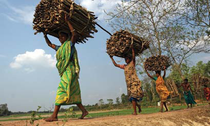
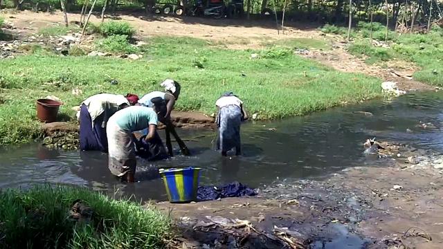
Africa is particularly vulnerable to climate change. It will exacerbate the economic, political and humanitarian stresses that countries in the region already face, and greatly reduce their capacity to eradicate extreme poverty. The poorest segments of society will be the most severely affected because they are also the least able to adapt. Responding to the threat of climate change will require concerted action on an unprecedented scale. Systematic action will be required across all levels of development planning and implementation (regional, national, sub-national, and local) if development in a number of countries is not to be reversed.
Some African countries have identified key vulnerabilities and priority adaptation measures, and others have initiated demonstration adaptation projects. However, countries continue to face a number of challenges including the following: (i) adaptation initiatives are limited in scope and scale, and their impacts are neither cohesive nor sustainable; (ii) institutional capacities, relationships, policies and practices to assess and manage climate change risks are not developed sufficiently to create an enabling environment, with corresponding political and social champions to support the formulation and implementation of efficient solutions to a problem that has complex multi-sectoral effects; (iii) limited knowledge of the most appropriate adaptation policies and measures hinders countries from preparing themselves with the necessary institutional capacities to support climate risk management; (iv) limited financing options to sustain scaled-up adaptation remains a constraint; and (v) it is difficult for countries to learn from each other about their experiences with different approaches to adaptation.
During the three years of its implementation (2010-2012), AAP laid the groundwork for an ongoing, dynamic adaptation process in harmony with each country’s social, environmental and economic priorities. In all 20 countries, AAP has nourished an environment in which decisions and activities in support of adaptation can be evidence-based, strategic and appropriate to the goals of sustainable development, resulting in long-term investment to increase resilience to climate change.
Strengthening Long-Term Planning Mechanisms
AAP’s Data and Information Management Component (DIMC) assisted countries to develop the infrastructure and capabilities needed to access, analyse and apply climate data and information for decision-making. Overall, over 10,000 people were trained in climate data analysis under AAP’s DIMC. AAP’s support under DIMC helped increase countries’ capacity to support vulnerability and risk assessments and use climate data and information to integrate adaptation into national development planning.
Building Institutional and Leadership Capacity
AAP assisted in enhancing professional leadership capacity and institutional effectiveness in countries by increasing awareness of climate change issues, developing multi-stakeholder approaches and implementing national adaptation strategies that address the needs of men and women equally. For example, under AAP, Kenya established a National Climate Change Secretariat to coordinate the different climate change focal points in key government ministries. Through this multi-ministerial coordination, Kenya has facilitated the National Climate Change Response Strategy and ensured adaptation interventions take a multi-sectoral approach.
Implementing Climate-Resilient Policies and Measures
AAP provided assistance to countries to implement policy measures that protect climate sensitive sectors and encourage private sector investment in adaptation, such as adaptation pilot projects and national climate change strategies. For example, Nigeria, with the support of AAP, adopted a National Policy on Climate Change and Response Strategy, which will ensure a coordinated approach to addressing climate change.
Innovative Finance
Under AAP, innovative financing options to meet national adaptation costs were expanded at the local, national, sub-regional and regional levels. For example, AAP supported Morocco to expand public-private partnerships to mobilise funds for future climate change projects in local communities. Through a public-private partnership developed through AAP, a solar lighting project was completed in a rural community. Additionally, AAP trained stakeholders to undertake cost-benefit analyses of adaptation options.
Generating and Sharing Knowledge
Through AAP, knowledge on adjusting national development processes to fully incorporate climate change risks and opportunity was generated and shared across all levels across all 20 countries. For example, the production and broadcast of television and radio segments (e.g. Burkina Faso, Mauritius, Namibia, and Tunisia) and documentaries (e.g. Cameroon, Kenya, Morocco, Rwanda, Senegal and Tanzania) effectively shared information and concerns on climate change adaptation.
Sudan's Second National Communication
The creation of a National Communication offers countries the opportunity to contribute with technically sound studies and information that can be used for designing mitigation and adaptation measures, and project proposals that can and will help increase their resilience to the impacts of climate change. Activities generally include: V&A assessments, Greenhouse Gas Inventory preparation, Mitigation Analysis or Education, and awareness raising activities. The ultimate goal is the integration of climate change considerations into relevant social, economic and environmental policies and actions.
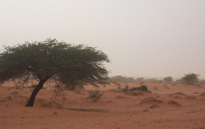
Major adaptation activities and needs that have been identified in Sudan include: community-based forest and range land management and rehabilitation and replacement of household goat herds with sheep herds to reduce pressure on fragile range lands. The unreliable nature of rainfall, together with its concentration in short growing seasons, heightens the vulnerability of Sudan’s rain-fed agricultural systems. The most extreme temperatures are found in the far northern part of the country, where summer temperatures can often exceed 43C and sandstorms blow across the Sahara from April to September.

Adaptation to climate change is a very compelling subject for the people of Sudan, burdened as they already are with devastating and recurring droughts, as well as severe hardships in the ability to coping with even current climatic variability.
Major adaptation activities and needs that have been identified across the five ecological zones include, Community-based forest and range land management and Rehabilitation and Replacement of household goat herds with sheep herds to reduce pressure on fragile range lands.
Sudan is the largest country in Africa. Its total area is over 250 million hectares, much of which is comprised of arid lands and desert.
Sudan lies within the tropical zone between latitudes 3o and 22o North and longitude 22 o to 38o East. Mean annual temperatures vary between 26oC and 32oC across the country. Rainfall, which supports the overwhelming majority of the country's agricultural activity, is erratic and varies significantly from the northern to southern ranges of the country.
The unreliable nature of rainfall, together with its concentration in short growing seasons, heightens the vulnerability of Sudan’s rain-fed agricultural systems. The most extreme temperatures are found in the far northern part of the country, where summer temperatures can often exceed 43oC and sandstorms blow across the Sahara from April to September.
These regions typically experience virtually no rainfall. In the central area around and just south of Khartoum, average annual temperatures are around 27oC, with rainfall averaging about 200 mm/year and rarely exceeding 700 mm/year.
- Sustainable development and the integration of climate change concerns into medium- and long-term planning
- Inventories of anthropogenic emissions by sources and removals by sinks of greenhouse gases
- Measures contributing to addressing climate change
- Research and systematic observation
- Climate change impacts, adaptation measures and response strategies
- Education, training and public awareness
In 1992, countries joined an international treaty, the United Nations Framework Convention on Climate Change, to cooperatively consider what they could do to limit average global temperature increases and the resulting climate change, and to cope with whatever impacts were, by then, inevitable.
Parties to the Convention must submit national reports on implementation of the Convention to the Conference of the Parties (COP). The required contents of national communications and the timetable for their submission are different for Annex I and non-Annex I Parties. This is in accordance with the principle of "common but differentiated responsibilities" enshrined in the Convention.
The core elements of the national communications for both Annex I and non-Annex I Parties are information on emissions and removals of greenhouse gases (GHGs) and details of the activities a Party has undertaken to implement the Convention. National communications usually contain information on national circumstances, vulnerability assessment, financial resources and transfer of technology, and education, training and public awareness.
Since 1994, governments have invested significant time and resources in the preparation, collection and validation of data on GHG emissions, and the COP has made determined efforts to improve the quality and consistency of the data, which are ensured by established guidelines for reporting. Non-Annex I Parties receive financial and technical assistance in preparing their national communications, facilitated by the UNFCCC secretariat.
Sierra Leone's Second National Communication
The creation of a National Communication offers countries the opportunity to contribute with technically sound studies and information that can be used for designing mitigation and adaptation measures, and project proposals that can and will help increase their resilience to the impacts of climate change. Activities generally include: V&A assessments, Greenhouse Gas Inventory preparation, Mitigation Analysis or Education, and awareness raising activities. The ultimate goal is the integration of climate change considerations into relevant social, economic and environmental policies and actions.
Climate Change is known to have adversely affected the environment, agriculture, food security, and even the lives and livelihood of large communities. Fishermen are known to have lost their lives in storms and passenger boats have encountered weather-related accidents, even though some go unreported. Flooding is known to have affected agriculture and habitats of people in Sierra Leone and their suffering has been aggravated by the attending health problems of water-borne diseases (typhoid dysentery cholera and diarrhea) due to lack of safe drinking water.
To view progress on Sierra Leone's SNC click here.

Sierra Leone has a tropical climate with two distinct seasons. The Dry Season (December to April) is dominated by winds from the northeast (i.e. the North-east trades), and the rainy season (May to November). Both seasons may have some variations in the commencement and duration.
Sierra Leone has developed many adaptation projects to address adverse effects of climate change based on existing coping mechanisms and practices such as Develop and enact appropriate policies and regulations relevant to the development of coastal communities, urban growth planning, and critical coastal ecosystems preservation and the Establishment of a National Sea- Level Observing System for Sierra Leone.
Sierra Leone has an area of 72,325 km2 between latitudes 6055’ and 10000’ North and between longitudes 10014’ and 13017’ West. The coastal zone of Sierra Leone extends for a distance of about 465 km. The configuration of the coastline and international boundaries of Sierra Leone encloses a very compact country. Sierra Leone is bordered in the northeast by the Republic of Guinea, in the south and southeast by the Republic of Liberia and in the west by the North Atlantic Ocean.
Climate Change is known to have adversely affected the environment, agriculture, food security, and even the lives and livelihood of large communities. Fishermen are known to have lost their lives in storms and passenger boats have encountered weather-related accidents, even though some go unreported. Flooding is known to have affected agriculture and habitats of people in Sierra Leone and their suffering has been aggravated by the attending health problems of water-borne diseases (typhoid dysentery cholera and diarrhea) due to lack of safe drinking water.
Key Vulnerabilities:
- Agriculture/Food Security
- Coastal Zones and Marine Ecosystems
- Water Resources
- Public Health
- Fisheries
- Land Resources
- Terrestrial Ecosystems
- Soils
- Biodiversity
- Energy
- Sustainable development and the integration of climate change concerns into medium- and long-term planning
- Inventories of anthropogenic emissions by sources and removals by sinks of greenhouse gases
- Measures contributing to addressing climate change
- Research and systematic observation
- Climate change impacts, adaptation measures and response strategies
- Education, training and public awareness
Potential Adaptation Measures:
Agriculture and Food Security
- Educational & outreach activities to change management practices to those suited to climate change
- Switch to different cultivars
- Improve and conserve soils
- Enhance irrigation efficiency and/or expand irrigation
- Establish seed banks
Water Resources
- Develop and introduce flood and drought monitoring and control system
- Improve or develop water management
- Alter system operating rules, e.g. pricing policies, legislation
Coastal Zones and Marine Ecosystems
- Develop Integrated Coastal Zone Management
- Develop planning/new investment requirements
- Protect, including building sea walls, and beach nourishment
- Retreat
- Research/monitor the coastal ecosystem
In 1992, countries joined an international treaty, the United Nations Framework Convention on Climate Change, to cooperatively consider what they could do to limit average global temperature increases and the resulting climate change, and to cope with whatever impacts were, by then, inevitable.
Parties to the Convention must submit national reports on implementation of the Convention to the Conference of the Parties (COP). The required contents of national communications and the timetable for their submission are different for Annex I and non-Annex I Parties. This is in accordance with the principle of "common but differentiated responsibilities" enshrined in the Convention.
The core elements of the national communications for both Annex I and non-Annex I Parties are information on emissions and removals of greenhouse gases (GHGs) and details of the activities a Party has undertaken to implement the Convention. National communications usually contain information on national circumstances, vulnerability assessment, financial resources and transfer of technology, and education, training and public awareness.
Since 1994, governments have invested significant time and resources in the preparation, collection and validation of data on GHG emissions, and the COP has made determined efforts to improve the quality and consistency of the data, which are ensured by established guidelines for reporting. Non-Annex I Parties receive financial and technical assistance in preparing their national communications, facilitated by the UNFCCC secretariat.
Guinea-Bissau- Second National Communication
The creation of a National Communication offers countries the opportunity to contribute with technically sound studies and information that can be used for designing mitigation and adaptation measures, and project proposals that can and will help increase their resilience to the impacts of climate change. Activities generally include: V&A assessments, Greenhouse Gas Inventory preparation, Mitigation Analysis or Education, and awareness raising activities.The ultimate goal is the integration of climate change considerations into relevant social, economic and environmental policies and actions.
Key Vulnerabilities identified in Guinea-Bissau's Second National Communication (2011):
- Agriculture and food security
- Water resources
- Coastal zones and marine ecosystems
- Forestry
- Tourism
Assessments and Background Documents
Potential adaptation measures identified in Guinea-Bissau's Second National Communication (2011):
Agriculture and food security
- Improved water management (through the promotion of irrigation and integrated water resources management).
- Sustainable development of agriculture (components: Integrated management and soil fertility, strengthening of support services to producers and dissemination of improved technologies).
- Improved management of other natural resources (components: organization of transhumance and route planning, sustainable management of forest resources and sustainable management of fisheries’ resources).
Forestry
- Monitoring of forests, based on research and application of credible technologies;
- The productive potential of the site, the extent of the growth period and the duration of the dry season should be the determining factors in the choice of species for use in reforestation and drought tolerance;
- The best places should be reserved for demanding species with regard to soil moisture;
- Reforestation with advisable orientation may increase the likelihood of survival of trees;
- In the scenario of temperature increase, which imply an increase of forest fires, we should promote the early warning system for risks of fire;
- Establishment of a regulatory and effective tax on wood for energy;
- Plantations of species with high calorific value and high growth
Water Resources
- Promote studies to evaluate the possibilities of building dams to retain rainwater in order to avoid the loss of these into the rivers, seas and ocean;
- Conduct a comprehensive study on the capabilities and characteristics of the river system (tributaries and small flowing streams) with the intention of its use for irrigation and construction of small dams to hold water for agriculture and livestock breeding;
- Construction of small ramps on the banks of the tributaries of the Geba River, in order to allow animals to drink the waters of these rivers;
- Organization and awareness to change mentality (creation of water user associations), to improve the level of knowledge of water resources (hydrology and hydrogeology) and its operation (training);
- Sustainable development and the integration of climate change concerns into medium- and long-term planning
- Inventories of anthropogenic emissions by sources and removals by sinks of greenhouse gases
- Measures contributing to addressing climate change
- Research and systematic observation
- Climate change impacts, adaptation measures and response strategies
- Education, training and public awareness
In 1992, countries joined an international treaty, the United Nations Framework Convention on Climate Change, to cooperatively consider what they could do to limit average global temperature increases and the resulting climate change, and to cope with whatever impacts were, by then, inevitable.
Parties to the Convention must submit national reports on implementation of the Convention to the Conference of the Parties (COP). The required contents of national communications and the timetable for their submission are different for Annex I and non-Annex I Parties. This is in accordance with the principle of "common but differentiated responsibilities" enshrined in the Convention.
The core elements of the national communications for both Annex I and non-Annex I Parties are information on emissions and removals of greenhouse gases (GHGs) and details of the activities a Party has undertaken to implement the Convention. National communications usually contain information on national circumstances, vulnerability assessment, financial resources and transfer of technology, and education, training and public awareness.
Since 1994, governments have invested significant time and resources in the preparation, collection and validation of data on GHG emissions, and the COP has made determined efforts to improve the quality and consistency of the data, which are ensured by established guidelines for reporting. Non-Annex I Parties receive financial and technical assistance in preparing their national communications, facilitated by the UNFCCC secretariat.
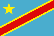
Democratic Republic of Congo- Second National Communictation
The creation of a National Communication offers countries the opportunity to contribute with technically sound studies and information that can be used for designing mitigation and adaptation measures, and project proposals that can and will help increase their resilience to the impacts of climate change. Activities generally include: V&A assessments, Greenhouse Gas Inventory preparation, Mitigation Analysis or Education, and awareness raising activities.The ultimate goal is the integration of climate change considerations into relevant social, economic and environmental policies and actions.
Key Vulnerabilities identified in the Democratic Republic of Congo's Second national Communication (2009):
- Water Resources
- Coastal Area
- Health
- Agriculture
- Land and Ecosystem Degradation
Assessments and Background Documents
Democratic Republic of Congo- Second National Communictation 2009 English (Executive Summary)
Democratic Republic of Congo- Second National Communictation 2009 French
Potential Adaptation Measures identified in the Democratic Republic of Congo's Second national Communication (2009):
Water Resources
- Evaluation and monitoring of the water resources, particularly those of the River Congo system and its tributaries.
- Evaluation of the impact of this system on the quantity and quality of underground water.
- The characterization and development of the watersheds identified in the city of Kinshasa for control of the surface run‐off.
- The protection of the water resources against pollution.
- Recourse to adaptation infrastructures capable of supporting the projected hydrological variations, and the economic, social and ecological costs of the adopted measures.
- The establishment of communities on the Kinshasa hill areas, after development, and on the BatÈkÈ Plateau in order to protect them from the injurious effects of floods.
Coastal Area
- Regulation of mangrove development
- Coastal Area Development Policy
- Delineation of building and residential areas
- Diversification of activities and rationalization of farmers/fishemen
Health
- Reinforcement of the medical personnelís professional capacities,
- Identification and destruction of the pathogensí hideouts,
- Organisation of preventive actions against vectorial diseases,
- Reinforcement of the cleansing system,
- Organisation of the populationís education and training, and the raising of its awareness,
- Improvement of the food supply system.
- Popularisation of the use of anti‐mosquito grids,
- Use of impregnated window screen,
- Eradication of mosquito deposits,
- Mosquito eradication on a national scale
- Reinforcement of the populationís nutritional capacities,
- The fight against social exclusion and community promotion
- Mapping of the habitat areas at climatic risk
Agriculture
- Use short‐cycle varieties, maize, rice and beans in particular
- Develop livestock breeding
- Upgrade alternative crops (peanuts and beans)
- Reinforce soil conservation activities
- Build reservoirs and water retention ponds
- Develop intensive livestock breeding
- Integrated crop protection
Land and Ecosystem Degradation
- Develop reforestation and soil conservation programmes
- Development of more efficient agro‐sylvo pastoral management methods
- Promotion of renewable energies and domestic fuels as substitution for ligneous fuels
- Participative and community management of natural resources by the civil society and the rural communities
- Sustainable development and the integration of climate change concerns into medium- and long-term planning
- Inventories of anthropogenic emissions by sources and removals by sinks of greenhouse gases
- Measures contributing to addressing climate change
- Research and systematic observation
- Climate change impacts, adaptation measures and response strategies
- Education, training and public awareness
In 1992, countries joined an international treaty, the United Nations Framework Convention on Climate Change, to cooperatively consider what they could do to limit average global temperature increases and the resulting climate change, and to cope with whatever impacts were, by then, inevitable.
Parties to the Convention must submit national reports on implementation of the Convention to the Conference of the Parties (COP). The required contents of national communications and the timetable for their submission are different for Annex I and non-Annex I Parties. This is in accordance with the principle of "common but differentiated responsibilities" enshrined in the Convention.
The core elements of the national communications for both Annex I and non-Annex I Parties are information on emissions and removals of greenhouse gases (GHGs) and details of the activities a Party has undertaken to implement the Convention. National communications usually contain information on national circumstances, vulnerability assessment, financial resources and transfer of technology, and education, training and public awareness.
Since 1994, governments have invested significant time and resources in the preparation, collection and validation of data on GHG emissions, and the COP has made determined efforts to improve the quality and consistency of the data, which are ensured by established guidelines for reporting. Non-Annex I Parties receive financial and technical assistance in preparing their national communications, facilitated by the UNFCCC secretariat.
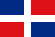
Dominican Republic- Second National Communication
The creation of a National Communication offers countries the opportunity to contribute with technically sound studies and information that can be used for designing mitigation and adaptation measures, and project proposals that can and will help increase their resilience to the impacts of climate change. Activities generally include: V&A assessments, Greenhouse Gas Inventory preparation, Mitigation Analysis or Education, and awareness raising activities.The ultimate goal is the integration of climate change considerations into relevant social, economic and environmental policies and actions
Key Vulnerabilities identified in the Dominican Republic's Second National Communication (2009):
- Agriculture
- Water Resources
- Health
- Tourism
- Biodiversity
Assessments and Background Documents
Dominican Republic- Second National Communication 2009 Spanish
Potential Adaptation Measures identified in the Dominican Republic's Second National Communication (2009):
Agriculture
- Climate scientific studies in agricultural production;
- Regionalization of crops;
- Introduction of varieties resistant to unfavorable climatic conditions;
- Improvement technologies and technological discipline in agricultural production;
- Redistribution of sowing areas between different crops;
- New techniques in agricultural production;
- Adopting new nutritional habits;
- Adaptation to new conditions as related to the integrated fight against pests and diseases in agricultural crops.
Water Resources
- The country must continue to receive economic and technical support in order to deepen its knowledge of priority objectives and support those strategies that will lead us to the desired scenario, both locally and worldwide.
Health (Malaria)
- Availability of a malaria epidemiological vigilance system, integrated and decentralized, which will allow for timely decision-making at all levels.
- An integrated and decentralized laboratory network which allows for fast and trustworthy diagnosis for an opportune and efficient treatment, based on health services.
- An integrated and decentralized entomological vigilance network which allows for information analysis for an efficient and timely vector control.
- Implementation of a health education strategy and an effective community participation, where all sectors of society would come together to optimize actions for the prevention and control of malaria.
- Sustainable development and the integration of climate change concerns into medium- and long-term planning
- Inventories of anthropogenic emissions by sources and removals by sinks of greenhouse gases
- Measures contributing to addressing climate change
- Research and systematic observation
- Climate change impacts, adaptation measures and response strategies
- Education, training and public awareness
In 1992, countries joined an international treaty, the United Nations Framework Convention on Climate Change, to cooperatively consider what they could do to limit average global temperature increases and the resulting climate change, and to cope with whatever impacts were, by then, inevitable.
Parties to the Convention must submit national reports on implementation of the Convention to the Conference of the Parties (COP). The required contents of national communications and the timetable for their submission are different for Annex I and non-Annex I Parties. This is in accordance with the principle of "common but differentiated responsibilities" enshrined in the Convention.
The core elements of the national communications for both Annex I and non-Annex I Parties are information on emissions and removals of greenhouse gases (GHGs) and details of the activities a Party has undertaken to implement the Convention. National communications usually contain information on national circumstances, vulnerability assessment, financial resources and transfer of technology, and education, training and public awareness.
Since 1994, governments have invested significant time and resources in the preparation, collection and validation of data on GHG emissions, and the COP has made determined efforts to improve the quality and consistency of the data, which are ensured by established guidelines for reporting. Non-Annex I Parties receive financial and technical assistance in preparing their national communications, facilitated by the UNFCCC secretariat.
Nigeria's Second National Communication
The creation of a National Communication offers countries the opportunity to contribute with technically sound studies and information that can be used for designing mitigation and adaptation measures, and project proposals that can and will help increase their resilience to the impacts of climate change. Activities generally include: V&A assessments, Greenhouse Gas Inventory preparation, Mitigation Analysis or Education, and awareness raising activities. The ultimate goal is the integration of climate change considerations into relevant social, economic and environmental policies and actions.
Nigeria, Africa's most populous country, has identified several priority adaptation actions which include: diversification and extension of protected areas for the conservation of ecosystems that are most vulnerable to climate change and sea level rise; maintaining ecological structure and processes at all levels and reducing existing pressure on natural ecosystems; reducing population and ecosystem vulnerability to climate change and reorientation of their evolution towards higher resistance to the changes; incorporating biodiversity conservation into adaptation strategies in the other sectors of the Nigerian economy; establishment and maintenance of protected area, and the active management of wild populations outside of protected areas; development and implementation of programmes for restricted areas and buffer zones, resource harvesting on a sustainable basis, ecological restoration, sustainable management and agro ecosystems; and monitoring to evaluate species and ecosystems stability from climate change perspective.
To view progress on Nigeria's SNC click here.

In order to minimize the negative impact of climate change on the ecosystems, water resources, socioeconomic domains, a number of adaptation measures are open to Nigeria. They range from education to inform and encourage behavioural change to changing location and use, preventing effects, modifying threats, and sharing loss.
Key Vulnerabilities:
- Agriculture/Food Security
- Water Resources
- Public Health
- Fisheries
- Terrestrial Ecosystems
- Tourism
- Energy
In Nigeria, in addition to autonomous adaptation, there must also be planned adaptation and adoption of strategies. These will include, among others: Diversification and extension of protected areas for the conservation of ecosystems that are most vulnerable to climate change and sea level rise; Maintaining ecological structure and processes at all levels and reducing existing pressure on natural ecosystems; Reducing population and ecosystem vulnerability to climate change and reorientation of their evolution towards higher resistance to the changes; Incorporating biodiversity conservation into adaptation strategies in the other sectors of the Nigerian economy; Establishment and maintenance of protected area (in situ preservation), and the active management of wild populations outside of protected areas (ex situ management); Development and implementation of programmes for restricted areas and buffer zones, resource harvesting on a sustainable basis, ecological restoration, sustainable management and agro ecosystems; and Monitoring to evaluate species and ecosystems stability from climate change perspective.
With an estimated population of over 170 million, the Federal Republic of Nigeria is the most populous country in Africa. Its 923,800 square kilometres occupies about 14% of West Africa. The country lies between 4oN and 14oN and between 3oE and 15oE. It is bordered on the north, east, and west by Niger, the Cameroon, and Benin Republic, respectively. The Atlantic Ocean forms the southern boundary. The total length of the coastline of the country is about 850 km.
The highest areas are in the east, north, and west, where land is generally over 1,500 metres, 600 metres, and 300 metres respectively. The low-lying areas, which are generally below 300 metres, lie along the coast and along the valleys of the main rivers. (Fig. 1.3). The Udi Plateau, which lies to the east, however attains a height of over 300 meters and this breaks the monotony of the coastal lowlands, which are also characterized by creeks and lagoons on both sides of the Niger Delta. West of the Niger Delta, the coastal areas consist of lagoons and swamps, separated from the open sea, by a strip of sandy land, which varies in width from 2 to 16 kilometres. The Lagos entrance is the only major outlet through which the lagoons and creeks drain into the sea. The section which lies in the east of the Niger Delta consists of creeks and swamps which stretch from Opobo town through the Cross River estuary to the border with the Cameroon.
The Niger Delta is a low-lying region, cut up by a complicated system of natural channels through which the River Niger finds its way to the sea. It is made up of three distinct subregions. They are (a) freshwater zone (b) the mangrove swamps, and (c) the zone of coastal sands and beach ridges. The freshwater zone, which starts from the apex of the delta, just below the town of Aboh, is essentially an extension of the lower Niger floodplains. The numerous water channels in this zone are bordered by natural levees, which provide the sites for most of the settlements and farmlands in the zone. The mangrove swamps, covering about 10,360 square kilometers and located to the south of the freshwater swamps, are sparsely settled. Strips of sandy beaches and ridges, which vary from a few meters to 16 kilometers, separate the mangrove swamps from the open sea. In addition to natural levees, ox-bow lakes are common landforms in the Niger Delta. The high rainfall in the region, coupled with the abundance of surface water and the flat terrain, create a serious drainage problem and makes road construction very difficult.
- Sustainable development and the integration of climate change concerns into medium and long-term planning
- Inventories of anthropogenic emissions by sources and removals by sinks of greenhouse gases
- Measures contributing to addressing climate change
- Research and systematic observation
- Climate change impacts, adaptation measures and response strategies
- Education, training and public awareness
In 1992, countries joined an international treaty, the United Nations Framework Convention on Climate Change, to cooperatively consider what they could do to limit average global temperature increases and the resulting climate change, and to cope with whatever impacts were, by then, inevitable.
Parties to the Convention must submit national reports on implementation of the Convention to the Conference of the Parties (COP). The required contents of national communications and the timetable for their submission are different for Annex I and non-Annex I Parties. This is in accordance with the principle of "common but differentiated responsibilities" enshrined in the Convention.
The core elements of the national communications for both Annex I and non-Annex I Parties are information on emissions and removals of greenhouse gases (GHGs) and details of the activities a Party has undertaken to implement the Convention. National communications usually contain information on national circumstances, vulnerability assessment, financial resources and transfer of technology, and education, training and public awareness.
Since 1994, governments have invested significant time and resources in the preparation, collection and validation of data on GHG emissions, and the COP has made determined efforts to improve the quality and consistency of the data, which are ensured by established guidelines for reporting. Non-Annex I Parties receive financial and technical assistance in preparing their national communications, facilitated by the UNFCCC secretariat.
Montenegro's Second National Communication
The creation of a National Communication offers countries the opportunity to contribute with technically sound studies and information that can be used for designing mitigation and adaptation measures, and project proposals that can and will help increase their resilience to the impacts of climate change. Activities generally include: V&A assessments, Greenhouse Gas Inventory preparation, Mitigation Analysis or Education, and awareness raising activities. The ultimate goal is the integration of climate change considerations into relevant social, economic and environmental policies and actions.
Montenegro has identified several priority sectors at risk from climate change related events, these include: water resources, coastal areas, agriculture, forestry, bio-diversity, and public health. Temperature rises in the Mediterranean are expected to lead to significant disruptions in local ecosystems due to severe weather events and the migration of invasive species into warming waters. These effects will likely lead to reduced productivity and public health concerns.
To view progress on Montenegro's SNC click here.
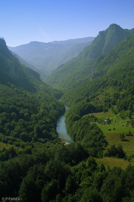
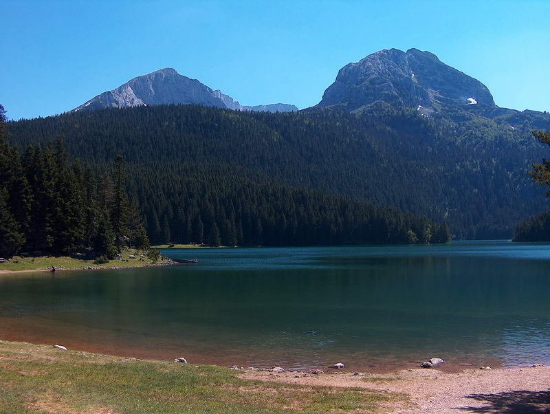
Montenegro is a mountainous country in the Southeast Europe which regained its independence in 2006. The total length of its land borders is 614 km. The section of the Adriatic Sea coast in the country is 293 km long. The total surface of the state territory is 13,812 km2, and of the territorial sea approximately 2,540 km2.
Geographic Characteristics
The northern part of the country is dominated by high mountains, descending through a karst segment in the central part with large depressions/plains, to a coastal plain varying in width from several hundreds of meters to several kilometers. The lowest part of the central inland area are the valleys of the Zeta River and the lower Moraca River, comprising the Zeta-Bjelopavlići plain with the Lake Skadar, the largest lake in the Balkans. The mountain ranges in the north include 37 peaks with heights above 2,000 meters. The deepest canyon in Europe, the Tara River Gorge with a depth of up to 1,300 m, is also located in the northern mountainous region.
Climate
The southern region of Montenegro and the Zeta-Bjelopavlići plain have Mediterranean climate, with long, hot and dry summers and relatively mild, rainy winters. The central and northern regions of the country have certain characteristics of mountain climate, although the influence of the Mediterranean Sea is also evident. The continental climate in the far north is characterized by large daily and annual temperature ranges, in addition to low annual precipitation, rather evenly distributed over all months.The average annual air temperatures vary from approximately 15.80 C in the south to 4.60 C in Žabljak. The duration of the sunny periods varies from 2,400 to 2,600 hours per year on the coast, i.e. from 1,600 to 1,900 hours in the mountains. Annual precipitation is very uneven, ranging from approximately 800 mm in the far north to about 5,000 mm in the far south. On the slopes of Mount Orjen, at the village of Crkvice (940 m above the sea level), precipitation may even reach 7,000 mm in record years.
Land Use
Agricultural land covers approximately 5,145 km², which is 37% of the total country area; about 6,225 km² or 45% is covered by forests, while the settlements, roads, rocky areas and other categories encompass the remaining 2,442 km² or 18% of the total territory.
Water Resources
The water resources distribution and abundance vary significantly in Montenegro. Generally speaking, with an average annual runoff of 624 m3/s (i.e. the volume of 19.67 billion m3), the territory of Montenegro falls among the water rich areas.
Forests
Forests occupy approximately 620,000 hectares or 45% of the total land area, while non-overgrown forest land takes up another 123,000 hectares (9%). The forest cover ratio is 0.9 ha/person. An overall timber stock is estimated to about 72 million m3, out of which 29.5 million m3 or 41% are conifers, and 42.5 million m3 or 59% are deciduous trees.
Coastal Area
The coastal zone (six coastal municipalities) encompasses approximately 11% of the national territory. This region includes a zone designated as special purpose coastal area (public maritime domain – “morsko dobro”), which is a narrow coastal belt with the surface of approximately 60 km2, including inland waters and the territorial sea covering altogether approximately 2,540 km2.
Environment
Significant sources of air pollution are the main industrial and energy complexes using old technologies, which as a rule apply no adequate mitigation measures. The transport-related air pollution is increasing, especially in city centers. The air quality, evaluated from the aspect of global indicators, is satisfactory. For particular pollutants and at particular locations, it is necessary to take some pollution prevention measures. In addition to communal wastewater (which is mostly discharged into the natural recipients without prior treatment), untreated industrial wastewater and inadequately disposed waste also make a significant contribution to the pollution of water bodies. The quality of surface waters is generally assessed to be good, with occasional non-compliance with the prescribed standards. Montenegro has a very rich flora and fauna, as well as diverse ecosystems. With approximately 3,250 plant species, the country is viewed as one of the floristically most diverse regions of the Balkan Peninsula, whereas the species-to-area ratio of vascular plants is very high, amounting to 0.837. The total share of protected areas in the national territory is 9.21%, and it mainly refers to the five national parks. The data on the generated, collected, treated and disposed volumes of waste, as well as on specific waste streams, are either incomplete or entirely missing, so the planning of waste management is still largely based on estimates.
Climate Change Pressures
Water Resources
Analysis show that in the territory covering approximately 90% of the country there is a reduction – deficit of annual precipitation that ranges even up to 20% in certain areas. As water resources have a high degree of correlation with rainfall amount and regime, identified reduction in rainfall will also generate changes in water resources. Changes in water resources are reflected in a pronounced amplitude and oscillations, yield reduction, a sharp increase in flood waters and longer periods with reduced capacity.
In the climate period 2071-2100, according to the model of correlation between the volumes of rainfall and runoff, the trend of change in flow of the Morača river water resource through Podgorica will be reduced by 31% compared to the climatological normal for the period 1961-1990.
Considering the scenario for the changes in precipitation and temperature until 2100, a strong disturbance in the balance of water resources is expected. given that there is a high degree of correlation between precipitation and the volume of flow and yield, in accordance with future climate scenarios, in which the precipitation is expected to decrease by different percentages ranging up to 50% in certain period (A2 scenario for the period 2071-2100), it can be expected that an overall water balance (water potential) will be reduced in certain areas even by as much as 50%. Climate change, especially in the precipitation regime, will determine the changes in water resources, as follows: in the first place a reduction of overall water balance, and then an increase of amplitudes of hydrological cycles.
Accordingly, even in the years with low overall water balance and expressed fluctuation, there will be periods with severe deficit and those with a high surplus in rainfall. Flood waves will become more common due to the increased intensity of rainfall. The most significant adaptation measures for water resources would include the establishment of a registry of water resources, individual water resource mapping, including all characteristics, and identifying areas of potential danger; water resources of fundamental importance, such as water sources, would have to be protected against any uncontrolled exploitation; establishment of high-level information exchange amongst institutions dealing with water resources as well as procurement of state of the art automatic masurment and control equipment.
Coastal Area
One of the consequences of global warming concerns increasing of the sea level. There are more reasons that lead to the sea level rising. In the first place, this is due to thermal expansion of water, caused by increasing sea temperatures. According to the estimates of the fourth IPCC report, the sea level is projected to rise by approximately 75% until the end of the century, as a result of thermal expansion, and only by 25% due to the melting of glaciers and the areas under the eternal ice.
The upper limit for the sea level increase in the basin of the Mediterranean Sea, including the Adriatic-Ionian basin, was +35 cm for the period 2071-2100 and the A2 scenario, of which +13 cm as a result of thermal expansion, +18 cm as a result of melting glaciers and permafrost, -2 cm as a result of changes in atmospheric pressure fields over the Mediterranean and +6 cm as a result of changes in circulation in the basin itself.
Rising of the Adriatic Sea level by approximately 35cm will provoke serious consequences. The water will continuously flood a large part of the coast that is now on the verge of flooding, and the tidal flood wave area will significantly increase, even in places that have never been targeted by the flood wave before. The naturally established equilibrium will be disturbed by the sea level rising. A large part of the beach area will be reduced, and some beaches will disappear, while the Bojana river will not be able to retain its natural flow to point where it joins the sea; the Bojana river delta will disappear; the torrential flows will not be discharged normally into the coastal waters, so that those will spread across the surrounding environment well before the imagined natural coast line, and this will lead to the flooding of areas which have not had such flood characteristics before.
The most important adaptation measures would include the development of a very high quality and operational service for monitoring the condition of the shore and the waves and warning about the existence of any danger a few days in advance, as well as the preparation of spatial planning documentation which should also include the effects of climate change on the coast, so as to prohibit the construction and urbanization in any zones that may be potentially exposed to dangerous tidal waves as a result of the new situation.
Agriculture
The analysis of agriculture as a vulnerable sector includes the effect of climate change on land, crop production and animal husbandry. Special attention is focused on the impact of the results of climate scenarios on crop production. The study included the calculation of reference evapotranspiration (eto), as well as of water demand by plants.
Looking at the obtained values of summary reference evapotranspiration in the winter period for 3 different scenarios, it can be seen that the scenario A1B (2001-2030) shows an increased value of eto as compared to the base climate scenario (1961-1990), by 3.6% to 8.7%. Lower values of eto increasing correspond to the coastal sectors with the Mediterranean climate, while the higher ones correspond to the mountain and continental climate. An increase in the reference eto for two scenarios relating to the period 2071-2100 amounts to 10.3-20.2% in the A1B scenario, and from 12-23.5% in the A2 scenario. The same increasing trend appears, as in the previous scenario, in case of the sectors with the Mediterranean, mountain and continental climate. expressed in absolute values (mm of water column), this increase is the greatest in the A2 scenario (2071-2100) amounting to 12 mm.
The most important adaptation measures include irrigation and drainage systems in regulating the water content in the zone of root systems, reduced tillage, deep tillage, surface covering with crop residue, soil spreading, or the density of planting may be modified, all in order to preserve a certain volume of moisture in the root zone system.
Forestry
The sensitivity of forest ecosystems to climate change impacts is commonly observed in the context of social capabilities and capacity of natural ecosystems to remain resistant or easily adaptable to the changed conditions in nature. The expected climate changes will result in the shifting of certain vegetation zones (forest types), both in terms of latitude and altitude. In some areas an increased drying of trees may be expects, as a result of stress and attacks of pests and plant diseases, as well as reducing weight gain, slower natural regeneration and greater damages caused by forest fires and atmospheric disasters.
On the basis of the results of climate scenario for the territory of Montenegro, expected changes in climate factors would have an adverse impact on the forest ecosystem, demonstrated by reducing moisture in the soil (particularly during the growing season when the plants need it the most), a prolonged duration of the growing season and hampered natural regeneration. Expected climate change will influence the disappearance of sensitive forest types (species with narrow ecological valence), shift climate zones, and thereby shift the borders of certain forest types (vegetation zones) in relation to latitude and altitude.
The most important mitigation measures include implementing forest management systems that support and protect sustainable forest management, natural regeneration of forests, increasing forest area, care and protection of existing forests, conversion of coppice forests into high forests; reconstruction of degraded forests; sanitary felling in forests affected.
Biodiversity
It is very difficult to evaluate the impacts of climate change on biodiversity because the changes occur slowly and the effects of these changes are always in interaction with other influences that have already caused certain consequences and reactions. In line with the expected climate change (increased temperature and reduced humidity), a reduction in and loss of species is expected, primarily those related to freshwater ecosystems, as well as species vulnerable to significant fluctuations in temperature and humidity environments (amphibians).
It is estimated that this may reduce and fully endanger the populations of amphibians and reptiles in karst areas of old Montenegro and karst regions of Kuča-Žijovo, as well as in the coastal mountains of rumija, Lovćen and orjen. A temperature increase in the continental part of Montenegro would eventually lead to acceleration of eutrophication of mountain lakes, and then to their withdrawal and complete disappearance.
Data on the phenology of woody species already indirectly indicate the presence of the consequences of climate change on the productivity of some ecosystems in Montenegro. Available data show that the listing of some species (black locust, linden, oak, maple, ash, beech, poplar, alder, pine, and maritime pine) begins a few days earlier than usual. Listing of given species begins around 12 days earlier than on average.
In relation to the marine ecosystem, the foreseen climate change would lead to faster eutrophication of shallow and confined parts of the sea waters, as well as the introduction of new thermophilic (invasive) species from southern marine biogeographic zones. Also, one of the main problems may be migration of marine species through the Suez canal, mainly from the red Sea, the Pacific and Indo-Pacific areas into the Mediterranean.
Significant measures to mitigate the consequences of climate change on biodiversity would cover the establishment of scientific infrastructure for the purpose of investigation of the impact of climate change on biodiversity, terrestrial ecosystems and the sea, training of experts; establishment of an intersectoral group which will deal with issues of water resources management and protection of biodiversity, etc.
Public Health
Climate change and weather conditions are related to human health in a complex manner. The changed climate has direct and indirect and predominantly negative effects on human health, causing changes and events in an organism which can cause injury, illness and disease with a fatal outcome. In addition to direct impacts on health and disease, climate change leads to a rapid growth, development and propagation of disease vectors (mosquitoes, ticks) that transmit malaria, leishmaniasis, sandflies fever, dengue, viral encephalitis and meningoencephalitis.
Climate change directly affects the availability of water, crop yield, production and quality of food, + as a consequence causes a higher frequency of disease due to impaired water supply and unsafe food leading to diarrhea, diarrhea, dysentery, salmonellas, hepatitis and others. The effects of air pollution and soil lead to a number of diseases and premature death.
There are no reliable health statistics in Montenegro on the effects of climate change on population health, illness and dying there, because no attributes necessary for such a complex evaluation are contained in the mandatory health records
Source: Initial National Communication on Climate Change of Montenegro, 2010.
- Sustainable development and the integration of climate change concerns into medium- and long-term planning
- Inventories of anthropogenic emissions by sources and removals by sinks of greenhouse gases
- Measures contributing to addressing climate change
- Research and systematic observation
- Climate change impacts, adaptation measures and response strategies
- Education, training and public awareness
Vulnerability and Adaptation Measures
In order to improve assessment of vulnerability and adaptation, as well as proposed measures for the next Communication, it would be useful to:
- Establish an expert/ advisory body for climate change and/or a separate body for vulnerability and adaptation;
- Establish particularly vulnerable areas by sectors, where more significant effects of climate change can be expected, and pay special attention to such areas in the formulation and implementation of sectoral policies;
- Strengthen the support to scientific research and improve cooperation/exchange of information among all stakeholders, and
- Establish databases by sectors and ensure their regular updating.
For the implementation of adaptation measures, the following needs were identified:
- Prepare the cadastre of water resources, protect the most important water resources, and improve water information system (including modeling, simulation, early warning).
- Provide for adjustment of spatial planning documentation to the effects of climate change in coastal area; preparation of a coastal zone management strategy, taking into account the impacts of climate change.
- Determine the sensitivity of particular agricultural regions to climate change, identify the most vulnerable ones; strengthen research and training of agricultural producers; disseminate information about the appropriate adaptation measures.
- Adjusted fertilizer application (control of mineral, promoting organic), reduced tillage, raising farmers’ awareness, reforestation, adapted techniques of irrigation, changing cultures and ways of cultivation; analysing suitability of regions for specific breeds and species of livestock, breeding livestock species that are resistant to heat stress and disease.
- Application of sustainable forest management, natural regeneration of forest resources,enhancement of forest stocks in general and of forests in the karst areas, increase in the area under protective forests; monitoring and risk assessment, are of crucial importance for adaptation.
- Collection of necessary data for the assessment of impacts of climate change on biodiversity, training of experts, awareness raising.
- Education, information dissemination to encourage changes in behavior and build awareness on the impacts of climate change on health and thus reduce the effects in the future; strengthening of information systems and systems for managing health risks from climate change, elaboration of preventive measures.
Potential Adaptation Measures
Coastal Zone Management
- Developing high quality and very operational services for monitoring the condition of the shore and waves, as the biggest potential danger, and early warning of the existence of danger, several days in advance;
- Amendments to the applicable legislation in the field of spatial planning in order to include the problem of climate change in coastal during the preparation of spatial planning documentation, so as to prohibit the construction and urbanization of the areas that will be exposed to potentially dangerous tidal waves as a result of the new situation;
- The existing infrastructure facilities should be resized to stand the load of new extreme climatic parameters and waves. This means that the existing buildings should be further strengthened and a maximally adapted to new climatic parameters and the new state of the sea level;
- Provide for maximum possible protection of water sources from the penetration of sea water.
- If possible, specific reservoirs should be moved to higher elevations, where only a few meters more would be enough to keep the situation completely under control;
- Some buildings should be demolished and the inhabitants relocated, thus allowing for an unimpeded propagation of strong tidal waves, with no consequences for the environment and the people;
- Some parts of the coast, will be completely flooded several times a year, and no life or existence will be possible to be established there. According to the present situation regarding the level of population and urbanization, it is expected that between 10% and 20% of the urbanized coast will be relocated, as a measure of adaptation.
Agriculture
Climate Change Impact: Reduction of organic matter in soil due to increased temperature and aridity that affect its faster decomposition.
Adaptation Measures: Application of organic fertilizers; System of recommendations for the application of mineral fertilizers on the basis of analysis of plant body-parts; Growing of leguminous plants and their plowing; Reduced cultivation
Climate Change Impact: Accelerated soil erosion, primarily through increased soil erodibility, a change in land use, increased rainfall intensity and longer dry periods.
Adaptation Measures: afforestation; implementation of new irrigation techniques; increasing awareness of farmers
Public Health
What needs to be done as a priority, through education and continuous information, is to encourage a change in behavior, build awareness of population about the impact of climate on health, and how to reduce the impact of future climate change. Necessary primary measures of adaptation for the purpose of prevention, preparedness and action to prevent, mitigate and adapt to climate change include:
- Permanent surveillance and control of health safety of drinking water;
- Maintaining and improving water and sewer infrastructure, with special emphasis on the coastal part;
- Air monitoring;
- Quality control and improvement of the food chain; production and implementation of national action plans for food;
- Strengthening of surveillance and control of communicable diseases;
- Strengthening of the already existing public health measures of disease control and health protection, especially for high-risk groups;
- Development and implementation of legal regulations concerning the environment and health;
- Strengthening of regional and international cooperation to manage the risks carried by climate change;
- Reform and strengthening of the public health sector for the coming climate change, its early organization and professional training in extreme situations, and especially well organized emergency medical services;
- Preparation of national action plans, strategies for the prevention of effects of climate change on human health, their mitigation, adaptation to new conditions, especially for extreme heat;
- Establishing a national system for early warning of impending disasters;
- Inter-sectoral collaboration, research, pilot projects and studies on the influence of meteorological parameters on health, which will help finding the correlation between climate change and health.
In 1992, countries joined an international treaty, the United Nations Framework Convention on Climate Change, to cooperatively consider what they could do to limit average global temperature increases and the resulting climate change, and to cope with whatever impacts were, by then, inevitable.
Parties to the Convention must submit national reports on implementation of the Convention to the Conference of the Parties (COP). The required contents of national communications and the timetable for their submission are different for Annex I and non-Annex I Parties. This is in accordance with the principle of "common but differentiated responsibilities" enshrined in the Convention.
The core elements of the national communications for both Annex I and non-Annex I Parties are information on emissions and removals of greenhouse gases (GHGs) and details of the activities a Party has undertaken to implement the Convention. National communications usually contain information on national circumstances, vulnerability assessment, financial resources and transfer of technology, and education, training and public awareness.
Since 1994, governments have invested significant time and resources in the preparation, collection and validation of data on GHG emissions, and the COP has made determined efforts to improve the quality and consistency of the data, which are ensured by established guidelines for reporting. Non-Annex I Parties receive financial and technical assistance in preparing their national communications, facilitated by the UNFCCC secretariat.
Mali's Second National Communication - June 2011
The creation of a National Communication offers countries the opportunity to contribute with technically sound studies and information that can be used for designing mitigation and adaptation measures, and project proposals that can and will help increase their resilience to the impacts of climate change. Activities generally include: V&A assessments, Greenhouse Gas Inventory preparation, Mitigation Analysis or Education, and awareness raising activities. The ultimate goal is the integration of climate change considerations into relevant social, economic and environmental policies and actions.
Key Vulnerabilities:
- Agriculture/Food Security
- Water Resources
- Public Health
- Fisheries
- Land Resources
- Biodiversity
Assessments and Background Documents
Mali's Second National Communication - Official Document (French) - June 2011
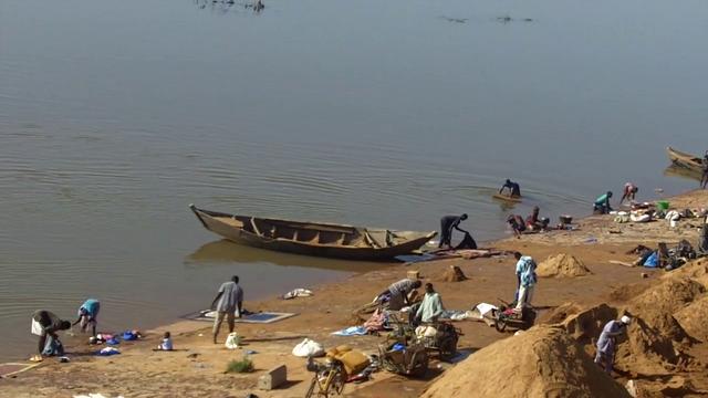
Mali is located in western Africa at a latitudes of 10 to 25°N, straddling the sub‐tropical band called the Sahel. The northern parts of Mali reach well into the dry Sahara desert, while the southern regions experience a wetter, more tropical, climate.
The seasonal rainfalls in Mali are controlled by the movement of the tropical rain belt (also known as the Inter‐Tropical Conversion Zone, ITCZ) which oscillates between the northern and southern tropics over the course of a year, and brings rainfall to the southern regions of Mali when it is in its northern position between June and October, peaking in August. The average rainfall in the wettest (southernmost) regions at this time is an average 300mm per month, but rainfall totals diminish rapidly with increasing latitude. In the dry months between November and March, almost no rain falls at all. Variations in the latitudinal movements of the ITCZ from one year to another cause large inter‐annual variability in wet‐season rainfall, which means that Mali suffers from recurring drought. The northern, desert regions of Mali receive very little rainfall all year round.
Source: University of Oxford, School of Geography and the Environment. Accessed on 23 November 2009 at: http://country-profiles.geog.ox.ac.uk/.
- Sustainable development and the integration of climate change concerns into medium- and long-term planning
- Inventories of anthropogenic emissions by sources and removals by sinks of greenhouse gases
- Measures contributing to addressing climate change
- Research and systematic observation
- Climate change impacts, adaptation measures and response strategies
- Education, training and public awareness
Potential Adaptation Measures:
Agriculture and Food Security
- Educational & outreach activities to change management practices to those suited to climate change
- Switch to different cultivars
- Improve pest and disease forecast and control
Water Resources
- Increase water supply, e.g. by using groundwater, building reservoirs, improving or stabilizing watershed management, desalination
- Decrease water demands, e.g. by increasing efficiency, reducing water losses, water recycling, changing irrigation practices
- Develop and introduce flood and drought monitoring and control system
- Improve or develop water management
In 1992, countries joined an international treaty, the United Nations Framework Convention on Climate Change, to cooperatively consider what they could do to limit average global temperature increases and the resulting climate change, and to cope with whatever impacts were, by then, inevitable.
Parties to the Convention must submit national reports on implementation of the Convention to the Conference of the Parties (COP). The required contents of national communications and the timetable for their submission are different for Annex I and non-Annex I Parties. This is in accordance with the principle of "common but differentiated responsibilities" enshrined in the Convention.
The core elements of the national communications for both Annex I and non-Annex I Parties are information on emissions and removals of greenhouse gases (GHGs) and details of the activities a Party has undertaken to implement the Convention. National communications usually contain information on national circumstances, vulnerability assessment, financial resources and transfer of technology, and education, training and public awareness.
Since 1994, governments have invested significant time and resources in the preparation, collection and validation of data on GHG emissions, and the COP has made determined efforts to improve the quality and consistency of the data, which are ensured by established guidelines for reporting. Non-Annex I Parties receive financial and technical assistance in preparing their national communications, facilitated by the UNFCCC secretariat.
Lao PDR's Second National Communication
The creation of a National Communication offers countries the opportunity to contribute with technically sound studies and information that can be used for designing mitigation and adaptation measures, and project proposals that can and will help increase their resilience to the impacts of climate change. Activities generally include: V&A assessments, GHG inventory preparation, mitigation analysis or education, and awareness-raising activities. The ultimate goal is the integration of climate change considerations into relevant social, economic and environmental policies and actions.
Lao PDR faces significant threats from climate change, in part because 75 per cent of its population depends on natural resources for their livelihood. The government has expressed concern regarding the impacts of climate change on flooding and rainfall patterns, which are said to be increasing and becoming erratic.
Floods and droughts historically have significantly impacted Lao PDR’s agriculture, forestry, water resources, health and economic growth. As such, these sectors have also been identified as priority areas for adaptation. Additional concerns are: a lack of capacity and knowledge with respect to climate modeling; a lack of scientific data on climate effects and potential impacts; low levels of public awareness; and a weak institutional setup that acts as a barrier to adaptation. Financial and capacity constraints are highlighted as major barriers to climate change action.
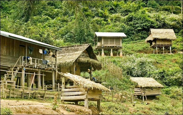

Lao People's Democratic Republic is located in the Indochina Peninsular (Mekong Region), bordered by China to the North, Vietnam to the East, Cambodia to the South, and Thailand and Myanmar (Burma) to the West and Northwest respectively with population of just over 6.4 million (CIA, 2011). Lao PDR had a ranking of 122 of 169 on the human development index in 2010 (UNDP, 2010), putting it near the bottom of the list of countries that have achieved a medium level of human development. The country’s per capital annual income in 2010 was approximately US$986 (USDS, 2010). The country’s economy is highly dependent on agriculture, representing 30 per cent of GDP and employing approximately 75 per cent of the country’s population.
The country’s climate is tropical and monsoonal, characterized by a rainy season from May to November and a dry season from November to April (USDS, 2010). In order to adapt to climate change a few projects based on assessed priority levels are in place including the project to strengthen the capacity if the national disaster management committees and the project to strengthen capacity of village forestry volunteers in forest planting, caring and management techniques as well as the use of village forests. Lao People's Democratic Republic has a total land area of approximately 236,800 km², 80 percent of which is mountainous. Mountains are found in the Northern region, the Annamite Chain (forming most of the eastern border of the country), and in the South, posing a significant natural buffer to storms that occur in the region. However, the remaining 20 percent of the country comprises mostly flat floodplains along the Mekong River. The lowest altitude of Lao People's Democratic Republic is 200 meters and highest is 2,880 meters. Lao People's Democratic Republic has a tropical climate, which is influenced by the southeast monsoon which causes significant rainfall and high humidity. The climate is divided into two distinct seasons: rainy season, or monsoon, from May to mid-October, followed by a dry season from mid-October to April. The average annual rainfall is about 1,300 – 3,000 mm. Average temperatures in the northern and eastern mountainous areas and the plateaus are 20°C , and in the plains 25-27°C.
Adaptation Needs and Priorities:
Lao PDR faces significant threats from climate change, in part because 75 per cent of its population depends on natural resources for their livelihood. The government has expressed concern regarding the impacts of climate change on flooding and rainfall patterns, which are said to be increasing and becoming erratic. Floods and droughts historically have significantly impacted Lao PDR’s agriculture, forestry, water resources, health and economic growth. As such, these sectors have also been identified as priority areas for adaptation (Sengchandala, 2010). Additional concerns are: a lack of capacity and knowledge with respect to climate modeling; a lack of scientific data on climate effects and potential impacts; low levels of public awareness; and a weak institutional setup that acts as a barrier to adaptation. Financial and capacity constraints are highlighted as major barriers to climate change action (DoE, 2000).
Knowledge of climate change issues has progressed over the past decade, but the barriers to implementation still largely remain. Capacity building at all levels of government would greatly support improved awareness and help generate accurate information and data on climate change and appropriate adaptation strategies in the country.
National Level Action:
Lao PDR submitted its First National Communication to the United Nations Framework Convention on Climate Change (UNFCCC) in November 2000. This document identifies raising awareness as one of the initial areas of focus for the country; the actual term “adaptation” only appears twice in the entire document, and is primarily referenced in relation to the need for a vulnerability and impact assessment of climate change risk. Subsequently, in 2008, Lao PDR established a National Steering Committee on Climate Change and a National Climate Change Office (Sengchandala, 2010). It also prepared a National Adaptation Programme of Action (NAPA) that was submitted to the UNFCCC in May 2009. It is currently developing its Second National Communication with the support of the United Nations Development Programme (UNDP).
In March 2010, Lao PDR approved a National Strategy on Climate Change (NSCC). This framework document identifies seven priority areas for adaptation and mitigation: agriculture and food security; forestry and land use change; water resources; energy and transport; industry; urban development; and public health (Sengchandala, 2010). The NAPA forms a central component of the NSCC. An overarching goal of the NSCC was to ensure that climate change was streamlined into Lao’s Seventh National Socio-Economic Development Plan (2011-2015). The NAPA, NSCC and current Development Plan have greatly strengthened the policy framework for climate change work in Lao PDR and have served to build awareness of the issue at least among senior government officials in the country. Despite this progress, a weak institutional setup is still seen as significant barriers to adaptation. In particular, a lack of coordination between the UNFCCC National Focal Point, the Water Resource and Environment Administration and other line Ministries limits integration of climate change adaptation policies into sector strategies.
Current Adaptation Action:
Lao PDR is benefitting from a number of adaptation projects, with a smaller number of national projects compared to multi-country projects underway in the country. Its level of activity, though, is low compared to other East and Southeast Asian developing countries. National projects are primarily focused on water, agriculture and disaster risk management, and are funded by the Asian Development Bank (ADB), the Global Environment Facility (GEF), Least Developed Countries Fund (LDCF), Nordic Development Fund and UNDP. Regional projects active in Lao PDR also are primarily focused on addressing adaptation concerns in the water and agriculture sectors, but also address disaster risk management and the provision of climate information services. These regionally focused projects are funded by the governments of Australia, Denmark, Germany, Sweden and the United States.
Assessment:
While climate change is characterized as a high priority in Lao PDR, it appears that capacity is lacking for effective implementation. This observation is reflected in the fact that the country’s highest adaptation priority is simply education and capacity building. Strides have been made in improving this capacity through the development of a NAPA and NSCC, supported by the LDCF.
Ongoing adaptation initiatives within the country are addressing many of the adaptation priorities identified by the country. There is a considerable amount of work occurring with the water and agriculture sectors, at both the regional and national level, as well as within the area of policy formulation and risk reduction. Gaps in Lao PDR’s climate change activities include a dearth of initiatives within the forestry sector, which has been identified as a top adaptation priority for the country. Forestry initiative may exist within the country under the banner of mitigation projects, and it is possible that these projects would entail adaptation co-benefits. Additional gaps in current programming include energy and transport, urban areas, public health and gender. In addition, it appears that the country has a lack of climate change expertise or accurate data. Going forward, Lao PDR could greatly benefit from the sharing and internal development of scientific and technical capacity for climate change generally and adaptation specifically.
References:
- Gass, Philip; Hove, Hilary; Parry, Jo-Ellen. (2011) “Review of Current and Planned Adaptation Action: East and Southeast Asia.” Adaptation Partnership / International Institute for Sustainable Development.
- Central Intelligence Agency [CIA] (2011). Laos. The World Factbook. Retrieved from https://www.cia.gov/library/publications/the-world-factbook/geos/la.html
- Department of Environment (2000). Lao People Democratic Republic: The First National Communication on Climate Change. Retrieved fromhttp://unfccc.int/resource/docs/natc/laonc1.pdf
- National Environment Committee (2009). National Adaptation Programme of Action to Climate Change. Retrieved fromhttp://unfccc.int/resource/docs/napa/laos01.pdf
- Sengchandala, S. (2010). Climate Change Policy of Lao PDR. Presentation to the 8th Workshop on GHG Inventories in Asia, Lao Plaza, 13-16 July 2010. Retrieved from http://www-gio.nies.go.jp/wgia/wg8/pdf/0-3_syamphone_segchandala.pdf
- United Nations Development Program (UNDP). 2010. Human Development Index 2010. Retrieved from http://hdr.undp.org/en/statistics/
- Sustainable development and the integration of climate change concerns into medium- and long-term planning
- Inventories of anthropogenic emissions by sources and removals by sinks of greenhouse gases
- Measures contributing to addressing climate change
- Research and systematic observation
- Climate change impacts, adaptation measures and response strategies
- Education, training and public awareness
The government’s main goals for climate change activities in the future are:
- increase public awareness activities on climate change
- implement a GHG mitigation plan
- regularly monitor and control climate change activities, for example data collection on temperature, rainfall, water flow, etc; and
- cooperate with international agencies on climate change activities and related issues
Climate change is a new concept in the Lao PDR. The understanding of this subject–the science, mitigation aspects, impacts and adaptations, and its relevance to Lao PDR’s economy – are mainly restricted to a few institutions and individuals. The Lao National GHG Inventory Project is the first exposure of policy makers and technical persons to the climate change issues. Though this project has built limited capacity, a much wider dissemination of this issue and capacity building would be required before the country is in a position to have a stated or fully considered national perspective on policies and measures to respond to climate change.
However, climate change activities in the Lao PDR have been growing since its participation at the Rio Earth Summit in 1992. Since then, interactions with IPCC and participation at COP (conference of the parties), including the above-mentioned project, have encouraged limited national consultations and activities relevant to the UN FCCC. These consultations and activities, while not constituting stated government policy, give indications of national thought on issues relating to climate change. Lao PDR is signatory to the FCCC, and ratified the Convention on 5 January 1995.
In 1992, countries joined an international treaty, the United Nations Framework Convention on Climate Change, to cooperatively consider what they could do to limit average global temperature increases and the resulting climate change, and to cope with whatever impacts were, by then, inevitable.
Parties to the Convention must submit national reports on implementation of the Convention to the Conference of the Parties (COP). The required contents of national communications and the timetable for their submission are different for Annex I and non-Annex I Parties. This is in accordance with the principle of "common but differentiated responsibilities" enshrined in the Convention.
The core elements of the national communications for both Annex I and non-Annex I Parties are information on emissions and removals of greenhouse gases (GHGs) and details of the activities a Party has undertaken to implement the Convention. National communications usually contain information on national circumstances, vulnerability assessment, financial resources and transfer of technology, and education, training and public awareness.
Since 1994, governments have invested significant time and resources in the preparation, collection and validation of data on GHG emissions, and the COP has made determined efforts to improve the quality and consistency of the data, which are ensured by established guidelines for reporting. Non-Annex I Parties receive financial and technical assistance in preparing their national communications, facilitated by the UNFCCC secretariat.